Thursday, June 30, 2016

June 24-29


June 24, 2016

Salamander Flats Campground

We met the man who is parked next to us.  His name is Paul and he is a retired 2nd grade teacher.  He brought his three grandsons up to hike in the woods.   Paul is very environmentally conscious and is training his grandsons to respect the land God has given us.  Today they took a large cooler on their hike and picked up trash along the trail.  The oldest boy is about 8 and his name is Gavin, Owen is next and Parker is 5. 

In the afternoon, Roger remembered we had a game that he thought the boys might enjoy. 
I think the game is called tether ball.  There is a stand made of pvc pipe with three colored cross bars.  The tether balls are small like a golf ball, but more flexible.  Two of the balls are connected by a cord.  The players get three chances to throw the ball onto one of the colored rods.  Each color is a different number of points, 1-3.  Whoever reaches 21 first is the winner.  All six of us played.  Roger won, Paul was second, and little Parker came in third, doing better than the rest of us.  Paul and the boys really enjoyed the game and hated to see us put it up.

Since Roger wanted to get up early tomorrow, we packed up the RV before going to bed.  Roger also made another fire with the last of our wood. 

June 25, 2016

The alarm went off at 7:30.  We drove up to a parking lot that was at a higher elevation, hoping to get better reception for Field Day, starting at noon.  Roger talked on the radio all day while I read a book.  Though reception was very poor, he persisted, trying his best to reach anyone who tried to contact him. 

Just before sundown, we returned to our previous campground, though we knew our spot would be taken, be just parked in the main open area buy several cars, whose owners were tent camping in the woods. 

June 26, 2016

We got up, ate breakfast and drove down the mountain to church.  After returning the rental car, we headed out of town.  While we both enjoyed Utah, we were ready to move on.  When we got to Bridle Falls, Roger decided we should hike up to where there were people sitting on a wide ledge about half way up the falls.  Somehow we made a wrong turn and ended up on a very steep trail that was pretty rough.  But we finally climbed up and met the much easier trail.  I admit, once we got to the falls, it was really fun.  The water was ice cold when I dipped my hands into it.  With it being the weekend, there were a steady stream of families and couples going up and down the trail.  


When we returned to the base of the mountain, we found a short path that lead to a stream and Roger took off his shoes and socks to put his feet in the water.  He said it must be close to freezing because his feet cooled almost instantaneously.  There was a small vendor selling shaved ice “snowballs” in the parking lot.  Roger bought a huge red one.  We couldn’t tell if it was strawberry or cherry, but it surely tasted good and helped us cool off more quickly.  

On the route we were taking today, we went by Deer Creek Lake again.  It reminded me that Paul had explained the wooden towers to us.  They were not for climbing lessons but were part of a zip line, with several stops along the mountainside.  As we passed it today I could see the line more clearly, as it is much earlier in the day and there was more light. 

The countryside east of Salt Lake City is filled with tall mountains that are rounded at the top with few trees.  They are covered with low growing shrubs and grasses.  We stopped at Strawberry Reservoir to watch the white pelicans.  There were several flocks at different places near the shoreline. 


One thing we haven’t specifically mentioned is that Utah is a very rocky state.  There are small, medium and large bounders throughout the countryside.  In the areas where people farm, there are often piles of rocks which appear to have been removed from the ground before planting of crops.  It must have taken a great deal of time and energy to do the initial preparation of the fields.

The farther east we travel, the more erosion is noticeable.  The rocks are broken and falling from the sides of the mountain.  One thing we have had a hard time adjusting to is the dust in Utah.  It is so fine that it gets on and into everything.  You just can’t avoid it.  Though I hate the summer humidity at home, I hate dust even more.

About 30 miles farther east the mountains look almost devoid of vegetation.  In actuality, they are covered with short grasses that are light brown.  They appear similar to a long line of huge piles of dirt that goes on and on for miles on both sides of the highway. The only green we see is irrigated fields or vegetation near a river or stream.        

Another interesting thing we have noticed, unrelated to geology, is that many businesses in Utah honor the Sabbath and are closed on Sunday.  It has been so long since we have seen that practice.  We supposed it must be because of the Mormon influence.  I can remember it was pretty much the norm when I was a child.  Living in Florida, where the tourist industry is such a major part of our economy, that soon took priority over the religious preference.

June 27, 2016

I spent this morning doing laundry, while Roger did research on campgrounds in Colorado.  After lunch we continued east.  Roger noticed tire marks all over the nearby hills. “Off-roading” seems to be a very popular sport in Utah.  We have seen lots of  dirt motorcycles and small open four wheeled vehicles, like the dune buggy’s we used to see on the beach at home in the 1960s.   

Today’s first stop was Dinosaur National Monument.  Whenever I think about dinosaurs, I visualize a cartoon character in a children’s movie.  But this site proves prehistoric creatures really existed.  The park service has a tram that drives people up the mountain to view the fossils in the Quarry Exhibit Hall.  The fossils date back 149 million years ago.  That is almost incomprehensible to me.   Earl Douglas discovered the first fossil at this location on 8-17-1909.  He was a paleontologist from Carnegie Museum in Pittsburg Pennsylvania.


The National Park has constructed a building around the side of the mountain, with two stories.  So people can actually see the fossils embedded into the rock.  There is one display that allows you to touch one of the large dinosaur bones. Since 1909, 400 different dinosaurs have been collected from this area.  There are 1,500 more fossil bones, from 100 different animals, and 8 different species remaining in the rocks that are part of the Monument.   

It was 4:30 p.m. when Roger finished doing his radio contacts.  Then we headed to Colorado.  The grasses on the side of the road are a soft golden color.  They seem to set off the silver and green shrubs and make them look prettier, somehow; not as harsh or brittle.  But, too soon, the landscape became very desolate.  The only manmade sights are oil drilling stations and holding tanks.  Many of the pumps are inactive (meaning they are not pumping).  There are also some different structures which Roger thinks may be for natural gas. 

Unfortunately, the highway was closed ahead and the detour took us on a rough gravel road.  We only past 3 vehicles during the hour drive.  There were no towns or people around anywhere.  So it was a little bit scary.  We finally passed a mine named American Gilsonite Company.  We don’t know what gilsonite is, so another internet search is in order.
(Later, when we had access to the internet, we learned that gilsonite is a resin used in the oil and gas drilling process.  It is also used in asphalt and some paints and stains.  The only place in the world where it is mined is in southeast Utah.) 
We were ever so glad to finally reach a paved road again.  But it was still another 20 minutes before we came back to the highway we had been on previously.  Oh well.  We are grateful to be safe and free from any mishaps along the way.  It still took another 20 minutes to reach the next town, Rangely, Colorado.
After about 90 miles the mountains began to be taller and are covered with evergreen trees.  There are green grasses again. And “Glory be!”  The air is getting cooler.  “What a joy “.  Of course, everything has a cost.  The steep incline was quite a stress on the motor home.  We reached the elevation of 8250 ft and pulled over to let the engine rest and cool off.  Roger had to keep a close eye on the thermostat going down the other side of the mountain. 
About half way down there was a small herd of cattle on the road.  Fortunately, they moved aside so we could pass them.   We had previously seen a sign that indicated that cattle had free range grazing on this land.  So it was not an unexpected encounter. 

We noticed several areas there a white substance seemed to leach from the rocks.  It didn’t look like salt, so Roger suggested it may be lime.  Later in the day we saw a building in town that was a lime company, so Roger was probably right.  We reached our next objective, the Colorado National Monument.  The ranger station was closed, so we started our drive up the mountain.  We came to a tunnel that we were pretty sure we could get through, but the one just beyond seemed too short for us to fit.  So Roger had to back down the mountain for several yards.  We had short range radios, so I got out and guided him to a pull off area where he had sufficient room to back around.  It was disappointing.  But we returned to town to a state campground that had electricity. 
We were able to take a hot shower and I put clean sheets on the bed.  So we felt better that evening. 
June 28, 2016
We spoke to a woman in the campground office who explained that the 10 ft height referenced for the low part of the tunnels at Colorado National Monument was only at the sides on the tunnel.  The center is 16 ft. high.  She said we should not have any problem getting through if we “hug the center line”.  So we went back up the mountain.  The park ranger on duty also assured us we could get through the tunnels.  Sure enough we did fine.  We had measured the RV this morning and it was 11 feet tall from the ground to the top of the AC Unit on the roof.

In the visitor’s center we read through the displays which explained the geology of the area and the different layers of rock.  They described the monument as “a fascinating landscape of deep canyons and soaring cliffs”.
After Roger did his transmissions, we ate lunch then drove through the park and took pictures of the cliffs.  The varied and unique formations created by erosion were quite remarkable.  When we got out and walked among the huge rocks, you could see thousands of tiny sparkles reflecting the sunlight.  They looked like diamonds. 
There was a shear drop from the road to the bottom of the canyon, so I was glad to be on the “inside” at least half of the time, rather than the cliffs side all of the time.  The switch backs were more intimidating than those we have driven in the Smokey Mountains.  Here you can see the “bottom” of the canyons.  The tremendous height is very evident, where as the Smokies are so covered with forests, it’s not nearly as scary.
We descended the mountain into the city of Grand Junction, Colorado.  Then we returned to the dry valleys that they called mesas.  They are comprised of light brown dirt and yellow grasses, with a few pale green shrubs.  After 50 or 60 miles we finally came to an area where trees are growing, land is farmed and cattle are grazing.  It was such a relief to see productive land again.
We see the mountains in the distance with snow still covering a considerable portion near the peaks.  This must be the west side of the Rockies.  We had not realized the Rocky Mountain extended this far south.  The town of Montrose is closest to our next stop, Black Canyon of Gunnison National Park.

We have noticed a different form of irrigation here in Colorado.  There are wide PVC pipes with holes in the side that lay along the side of the fields.  The water flows out on the ground down the tracks between the rows of crops.  Roger says this is probably more economical because so much water is lost by evaporation with a sprinkler system.
We have now started to drive by mountains covered with short juniper trees.  The air is so cool that we have turned off the AC and opened the windows.  We reached 7,000ft. , then 8,000 ft. and could hardly believe we were still ascending.  Pretty purple, yellow and orange wild flowers decorate the sides of the road. 
We found a campground with electricity in Black Canyon National Park and settled in for the might. 

June 29, 2016-06-29

This morning we went up to the visitor’s center that overlooks Black Canyon.  Neither one of us expected to see anything different.  But this canyon was very unique.  We have seen so many mountains that exhibit horizontal striations of different colors of rock.  Black Canyon has vertical ridges, instead.  It is so deep and so sheer and narrow that very little sunlight can penetrate.  It is very dark.  That is why it was named t Black Canyon.

Roger spotted another new bird today.  It is the violet-green swallow.  There were several of them flying around the top of the gorge near the visitor’s center.  He were very easy to identify because they flew very close to the observation area where we were standing. 

We reached 7,000 ft. then 8,000 ft. and could hardly believe we were still ascending.  Pretty purple, yellow and orange wild flowers decorated the sides of the road.  This canyon is such a great surprise.  It is the narrowest we have seen so far.  An information sign in the visitor’s center explains that the structure of the canyon was created due to the steep descent of the Guinnison River. This caused a very rapid flow of water, hence quicker and more powerful erosion of the surrounding rock.

We left the canyon at 10:50 and turned south.  I’m dreading the heat, but we can’t avoid it forever   I also hate to leave the green trees that live on the higher elevations.  Gratefully, highway 550 begins on a plateau.  The morning temperature is pleasant and trees and fertile land border the highway.  It appears that we have received a short reprieve from the heat.  It is actually a delightful drive.  We have followed a pretty stream for the past hour, then past a beautiful lake.  There are tree covered hills on both sides of the road and the snow covered Rocky Mountains can be seen in the distance.     \

The elevation is 6,900 feet.  I have only just realized that we are traveling through the San Juan Mountains.   They border the Rocky Mountains on the west side.  Oh how lovely to see green grass again!  At 7,700 ft. the mountains are awesome!  We feel so small, but it is an exhilarating feeling as well.  We arrived at Ouray, a small old mining town with businesses lining Main Street.  They have a hot spring which has attracted many tourists.  The old mining community has kept up the wooden buildings and painted them with bright colors. 

After passing through town, we have now reached an elevation of 8,700 feet and there is a spring shooting out of the side of the mountain.  We passed an old sleuth at 9,050 feet.  And the temperature has gotten cool enough to close our windows.  Some of the rocks are orange, some yellow and the rest were grey.  There was a rushing stream along the side of the road and the rocks in the stream are a dark orange.  (9,500 ft.)  We wondered if the color is from copper or iron.  (9,594 ft.)  We have now reached a view of the tree line, where trees can no longer grow, 9,650ft.  At 9,680 we see the peaks are a dark orange, something we have never seen before.  9,700 ft. then 9980, and then 10,000 ft.  At
10, 200 feet it starts to rain.  WOW!.  What a spectacular view, even in the rain.  10,453 ft. and still climbing.
 

We stopped at an overlook that had three different informational signs.  One noted that there were 20 different mines in this area in the 1800s.  Silver, copper, gold, lead and zinc were mined here, producing over 30 million dollars worth of minerals.

We were delighted to have a rest stop at 10,500 feet and watch the rain.  We actually took a nap while letting the RV have a rest as well.

The orange rock, bright white snow and green trees are a beautiful sight.  Clouds have formed where the cooler air and the moisture mixed.  We had a view of waterfalls at 10,900 ft. and small patches of snow clinging to the sides of the mountain at 11,000 ft.  The top of Red Mountain Pass is 11,018 ft.  A sign at this point noted that wagons carrying gold past here in 1878. 

It’s down hill from here.  The snow reminded us when Tricia was an infant we saw snow in May at Flagstaff, Arizona.  Today we are seeing snow on the ground in June.  How extraordinary!  The San Juan Mountains really are beautiful.  I’m so glad Roger routed us through this wonderful mountain range. 

We arrived at Silverton, an old mining town where a small gauge railroad travels south to the city of Durango.  It follows a stream that flows swiftly down the mountain and has wild daisies decorating the shoreline.  As we continued to descent the mountain we saw remnants of an old mine on the hillside. 


Roger has been very courteous to the cars following us.  He pulls over to the side to let them pass, as they are traveling faster than we are.  Hopefully, that will contribute to a more positive impression of the motor home owners.

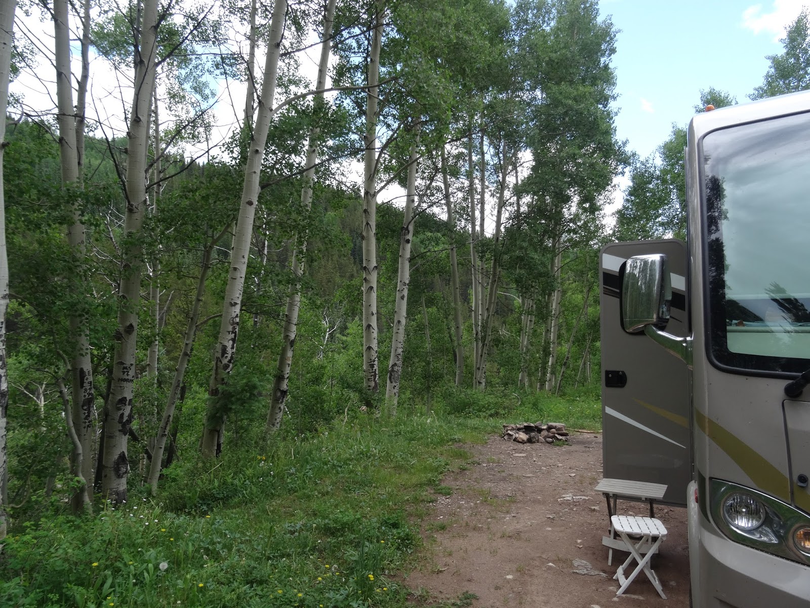
We found a free camping area (with no services) in a national forest and settled in for the night.  There was a ring of rocks for a fire pit, so we both started looking for dry wood.  After collecting dead branches for about 20 minutes, Roger started a fire.  Then we made spaghetti together and took it outside to eat beside the peaceful flames.  


Sunday, June 26, 2016

June 20-23


June 20, 2016

Today we drove north to reach Antelope Island, the largest island in Salt Lake.  It is a State Park that was not explored by “anglo” people until 1845.  Kit Carson and John Fremont named the island after observing “several pronghorn antelope grazing on the rangeland”.  It is 15 miles long and 4 ½ miles wide.  The highest peak is 6,596 feet above sea level.  I was surprised to learn that the oldest rocks on Antelope Island are 1.7 billion years old, the same age as those at the bottom of the Grand Canyon.  Artifacts found on the island reveal that people inhabited this land more than 6,000 years ago.   

There are several freshwater springs on the east side of the island that support the wildlife.  In 1893 12 bison were introduced to the island. Today there are over 500.  Each year   there is a round up in the fall, where extra bison are sold, to maintain a healthy herd.  It is so good to see them thriving on the island.  We didn’t actually see any antelope, but there is only one road on the island, so our view was limited.  The brochure states that these animals can run as fast as 70 miles per hour, so we were sorry we missed them.  

Other animals that roam freely on the island are mule deer, bighorn sheep, coyotes, bobcats, badgers and numerous birds, including owls, hawks and falcons.  (As soon as I read about the badgers, I thought about the animal we had seen in the City of Rocks.  I’m pretty sure it was a badger.)  We were able to sight two new birds for our list:  the yellow headed blackbird and the ruddy duck.  I was very glad about that.

When we returned to the RV, we decided to go to a movie.  There was a theater in the shopping center next to where we had parked the motor home.  We saw “You Before Me”.  Both of us enjoyed it, because the acting was so good.  I especially liked the female lead, though I don’t remember her name.

June 21, 2016

We drove into Salt Lake City and toured the Capitol Building.  It was very interesting.   
 The outside has 52 Corinthian columns made of local granite.  There are two lions, one seated on either side of the steps.  The brochure states that the lions are a symbol of “pride, strength, authority and protection”. Another symbol of the state of Utah is the beehive, which can be seen through out the building.  Even the locks on the huge entrance doors are in the shape of a bee hive.  The beehive is the center of the State seal and is symbolic of industry and unity.  The state road signs also have the picture of a beehive with the number of the route in the center.

The second floor walls are made of a very unique type of white marble.  Each section has a mirror image of the one next to it.  That such a thing even exists is a marvel to me.  There are 24 solid marble columns in the rotunda, which are the largest in the United States.  The marble came from Georgia.  Other parts of the building have the native marble, which is brown with orange and purple highlights.

The room where formal receptions occur is called the “Gold Room”, because there is gold leaf decorating the ceilings and around the frames of the mirrors.  The chairs are upholstered in green brocade, in Queen Elizabeth’s monarch pattern.  There are four crystal chandeliers hanging from the ceiling, which originally cost $45,000.  In today’s market they would be valued at over a million dollars.

GOVERNOR Rockwell addresses the nation. 


One of the other important ideals reflected in the capitol building is “transparency”.  The people of Utah don’t believe in “closed doors”.  The building belongs to the people of Utah and they can come in without being searched or going through metal detectors.  There are no armed guards.  Citizens are welcome to sit in the galleries of the senate and house chambers whenever they wish.  To demonstrate this quality, each floor of the building has natural sunlight. There are numerous windows in the ceilings.  Even the floor of the rotunda has transparent tiles that lets light filter into the basement floor. 

The Utah legislature only meets 45 days a year.  There are 75 representatives and 29 senators.  The gallery in each chamber has monitors that show the order in which each bill will be reviewed, so that people can plan when to be present to hear the discussion.
      
The history of the state is familiar to most people.  Brigham Young brought his Mormon followers to settle at Salt Lake City in the 1800s.  But we were unaware that the people had to wait 40 years before their request for statehood would be granted.  It was not until the Mormon Church renounced polygamy, that they were allowed to join the union.

We also learned that the Ski industry is one of the most productive in the state, earning billions of dollars per year.  It stared when two Norwegian brothers named Engen, who were premier skiers in their own country, were asked to travel to Utah to build a ski ramp.  Not only did they build the ramp, but they chose to remain in Utah and began a ski school.  Utah has what is called “dry snow”, which is more difficult to ski on.  So when you learn on dry snow, you can more easily ski on wet snow.  This has made Utah a very popular place to learn the sport. 

One of the most famous of Utah’s citizens was a man named Farnsworth.  He was the inventor of the vacuum tube and television.  There was actually a court case where RCA filed suit against Farnsworth claiming they had invented TV.  Fortunately, all of Farnsworth’s original drawings had been preserved, with documented dates retained by one of his professors.  This proved a far earlier date of discovery than RCA.  So the court declared Farnsworth official inventor of the television.

While we were in the Senate chamber, our guide pointed out a miniature traffic light sitting on top of one of the desks.  He told us that it was a reminder that the traffic light was invented in Utah.  Another “first” that is attributed to Utah is depicted in one of the half moon shaped murals of the vaulted atrium.  It is called “Seraph Votes”.  She was the first women to vote in a state election. 

While we were doing the tour, our guide mentioned different products of Utah.  I found out that what I had called “red clay” a few days ago is actually copper.  It is being mined just north of Salt Lake City.  The guide called the process “open” mining, which a more gentle term for “strip” mining.  I still think it looks awful, from an aesthetic point of view.

When we returned from our tour of the Capitol, Roger decided to take a different route up into the Timpanogos mountains .  We headed up to Silver Lake.  It is located on a gravel road that was very rough and dusty.  But Roger is quite an explorer, who loves a challenge.  So I said my prayers that we don’t get a flat tire along the way.  Though the lake is quite small, it has a lovely view of the mountains.  

We had seen some hand written signs along the route that said “Stray” which confused us.  Then Roger discovered a group of people with trucks and tents, just beyond the end of the road.  He went to see what was going on and discovered it was a filming crew.  The title of the film is “The Stray”.  It is about a family hiking in the mountains and a stray dog.

When we drove back down the mountain, Roger tried to look up more details about the movie.  He found out there were numerous movies with the same title.  So he was very disappointed.  He wanted to go see the movie when it comes out.  He hoped to find the film crew before we leave the area, so he can get more details.

June 22, 2016
                       
Today we drove the loop road around the mountain.  We reached a place called the Alpine Summit that noted an elevation of 8060 feet.  Roger found another dirt road he wanted to explore.  We did discover some beautiful views of the mountains with the contrast of the bright white snow against the dark gray rock, so striking in appearance. I really think it is prettier now than it is when completely covered with snow.   But it make me feel sad that it will soon be completely gone in the hot weather.  

We noticed that there are many more wild flowers at this higher elevation.  I guess the cooler temperature allows them to flourish up here.  The one I particularly love is the brightest true blue color I have ever seen.  There was one small field that was covered with a yellow daisy like flower with thick long leaves.  Aspen trees are almost everywhere you look, small, medium and large sizes.  There white bark with its contrasting black knots is so distinctive. 

Once we retuned to the main highway, we came to a place called Cascade Springs.  Roger had to talk me into hiking the trail and I was so glad he did.  There were little wooden bridges over the small cascading water falls.  Metal display markers pointed out the names of different trees and plants.  Others explained the names of different wildlife that can be found around the springs.  One plaque stated that there is a constant flow of water from the springs which is equal to 1800 average sized glasses of water per second.  Isn’t that amazing!  Especially since the area where they flow out of the ground is only about 75 to 100 feet across. 

There was also a sign that showed where the water comes from.  A diagram drawing
shows that rainfall from an adjacent mountain sinks into the ground, then the artesian spring pours forth water at the base of the next mountain.  What is still a question to me is how the earth self regulates the water so it always flows out at the same rate.  I guess this is another internet question to research.  

As we were returning on the back side of the mountain, we passed a huge reservoir that is also a state park.  There is a swimming beach, picnic area and boat ramp.  There were quite a few boats out on the lake.  Some were water skiing, others just boating or fishing.  It was good to see so many people using the lake on a week day.  Adjacent to the lake were several unusual climbing structures.  They appeared to be used as a training area for rock climbers.  It was different from anything we have seen before.

The last site along our route was Bridal Veil Falls.  This is a very high waterfall which, though lovely, was not what impressed us the most.  It was what we saw on the waterfall that almost shocked us.   There were people climbing up the rocks to a flat shelf about midway up the mountain.  It looked like an almost vertical climb.  These Utah residents are mighty hearty people: bikers, rock climbers, hikers, off road vehicle drivers.  They certainly love challenging nature.  

You know I can’t end a day without a bird being part of the story.  Yes, we did sight another new bird.  While we were in Cascade Falls we discovered several yellow warblers.  They are almost completely yellow from head to tail.  The female is almost the same as the male, but has small rusty streaks of her chest. 

When we got back to the motorhome, Roger started a fire, using logs we had found left behind by some other campers.  He also had purchased some additional wood when we stopped at a filling station to add propane gas to our RV tank.  Fortunately, the evenings in the mountains have been cool, so the fires have been very enjoyable.

June 23, 2016

I’m not sure if I mentioned it before, but we decided to stay in the area for a week, because Roger ordered some cables to be delivered to the local post office, general delivery.   This weekend is a major national field day for the amateur radio operators.  He hopes the elevation at our campsite will allow him favorable conditions.  So we have been parking the RV and rented a car for the week.  We have been using the car to do all our exploring in the area, because it is so much easier.  Then we have a car for church this weekend.

Roger's part for the radio came in so he drove into town to the post office to retrieve.  On the way back he found some young kids that had set up a Lemonade stand.  Always encouraging the free enterprise system he stopped to negotiate a deal.  It was late in the day and they only had about a half of quart reaming to be sold.  At .25 a cup the young sales person figured he had about three dollars remaining.  Roger offered $5 if he would through in the container as he had no way to get the product home.  A deal was made.  The" lemonade" was a concoction of  lemonade and various chunckes of fruit.  (Watermelon, pineapple, coconut). Hes says  Its the best dang drink he has ever had especially on these hot days.  He is going to miss it when its gone.

Today we have just stayed in the campsite.  I have been typing our blog and Roger has been setting up his hex beam antenna. 

June 17-19


June 17, 2016

When we had driven in to Ogden yesterday, we were amazed at the size of Salt Lake.  It looked like an ocean, from our perspective.  Today, we drove into Salt Lake City, about 30 miles south of Ogden.  I was surprised that the eastern side of the city is flanked by a tall mountain range.  It must be very high because there is still snow at the peaks. Roger found a very pristine campground that had wifi.   So we spent the day paying bills on line, down loading pictures and posting on the blog.  

June 18, 2016

Summer has finally found us.  It says 88 degrees on one of the bank marques.  But at least the humidity is nothing like at home.  We spent a couple of hours trying to find out the exact location for our next site.  We went to a local library and got help from the lady at the information desk.  She even called the visitors center for us.  There was some place in the area where the California, Mormon and Pony Express Trails all converged.  The librarian finally referred us to a place called “This is the Place Heritage Park”. 

The first four words were those spoken by the Mormon who had led his fellow believers to settle in Salt lake City, Utah.   When we arrived at the park, we walked around the grounds.  There are several bronze statues through out the park, mostly related to the Mormon settlement.  Another smaller area is set apart for a huge sculpture depicting the Pony Express Rider and the Station Attendant who cared for the horses.  There was even a replica of the small wooden building that represented the pony express station.

The radio band was very noisy, so Roger had some trouble getting contacts.  After a couple of hours, we drove to St. John the Baptist Catholic Church for 5p.m. Mass.  Then we headed south to our next site: Timpanogos Cave National Monument.

We were glad that our route took us away from the city and toward the mountains, hoping for cooler temperatures.  Shortly, it became clear that we had gotten our wish, as we climbed to an elevation of almost 5000 feet.  The visitor’s center was closed, but we were able to get a map from a park ranger who was giving a class.  It showed us the location of several campsites.  The first one had a sign that said “full”.  The next one we drove through was also full and/or had reserved signs posted.  Fortunately, in the third campground, just before dark, we found a “double site” with just one young family. 

We got out and talked to them.  They said we were welcome to stay, if we did not have any dogs.  They had two dogs that don’t get along with other dogs.  One of the dogs was  big enough to be a pony, with long white hair.  The other was still a good sized dog.  But both were very friendly.  Shawn is in the National Guard and Alyssa is a stay at home Mom.  Their little girl is about 4 and her name was McKenna.  The site was very nice, though there was no electricity.  There was a small creek, with swift running water that was right beside the RV.  When the attendant came to collect the fee for the site, Roger paid for the whole site.  They were most appreciative.

June 19, 2016

It was a beautiful morning with clear skies.  The stream must come from several streams converging from higher elevations, where the snow is still melting.   Butter flies are flying all around the park.  They are yellow with black edges around their wings.  After saying good-bye to our campmates, we drove back down the mountain to get a campsite in the first campground.  We selected one and paid for it.  Then Roger drove back into the city hoping to get the oil changed.  Almost every place he tried was closed on Sunday.  Finally called Pep Boys and they were open.  But when we arrived, the RV was too high to fit in their building.  So Roger bought the oil filter and oil to have it when we find a place later in the week.  

Roger returned to “This is the Place” National Monument Park, because the radio band conditions were so much better today.  He was able to talk to 75 stations in less than an hour, a considerable improvement on yesterday.  When he finished, we drove back to our campsite, arriving about 6p.m.  It was so much nicer than last night.  We were on a paved parking area, with a nice picnic table and a brick fire pit.  Roger found some wood and we plan enjoy a fire later.  We were still next to the rushing stream and put our feet in the water to check the temperature.  It was pretty cold.

We took a short walk on a paved path around the back side of the stream.  On our way back, a Mexican family invited us to share their meal with them.  There were two sets of parents with two children, each, and grandparents.  They were so courteous and were very interested in our travels.  We talked for a long time and thanked them for their wonderful hospitality.

Both Bill and Tricia had called Roger and wished him happy Father’s Day, earlier in the day.  So we count this as another blessed day!

Friday, June 17, 2016

June 15-16


June 15, 2016 

Roger decided not to stay at Craters of the Moon another night.  We packed up and left at about 1p.m., because we could not get cell phone coverage.  Just as we pulled onto the main highway, a coyote crossed the road in front of us.  It is just so exciting to see wildlife that does not live in the eastern part of the country.  We have seen several more marmots, which have made me wonder if they cause the farmers any problems.    

It is overcast today, which actually makes it easier to see, as there is less glare.  We were able to spot another prairie falcon perched on top of a small outcropping of rocks.  Just a few feet away, Roger saw another animal we haven’t yet identifies.  It was about 18” tall and was standing on two feet.  He reminded us of a beaver, in appearance, but there was no water anywhere around.  I thought he might be a large marmot, but I’m not sure they grow that big.  We’ll have to check the internet, whenever we can get the internet again. 

We past one farm that had sheep and goats, which seemed a strange combination, or at least unusual.  I can understand the sheep.  They probably take less care than cattle.  But I’m not sure if the price of goat’s milk would be sufficient to warrant raising them.  That is another interesting question for internet search, later on. 

Having been driving along a relatively flat prairie, we were surprised, yet again, when we came over a small rise and saw a huge deep valley off to our right.  There were two large signs explaining that this valley is where Hagerman Fossil Beds are located.  This was Roger’s next destination, because it is a National Monument.  The sign stated that the fossils found here were left from a 3,400,000 year old pond on the bluff across from the Snake River, which you can see from this overlook.  It further explains that the climate during this prehistoric period was much wetter than it is now.  Some of the fossils revealed a zebra-like animal, beaver, otter, pelicans and other water birds.  The second sign notes that the highway we are traveling on now is the home to a “Thousand Springs”.  They flow underground then “converge from a basalt bluff into the Snake River”.    

After Roger made his minimum contacts on the radio, we headed for Minidoka National Historic Site, only about 40 miles away.  (We saw two more of those beaver-looking animals on the side of the interstate, next to their burrows.)  Minidoka is the site where “10,000 Japanese Americans were victims of wartime hysteria”.  Between 8/16/42 and 10/26/45, this 950 acre camp housed Japanese people in barracks, behind barbed wire fences, watched by guards armed with machine guns.   
They lived a “bleak, humiliating life” for 2 ½ to 3 years.  Most were “US born citizens, loyal to the principles and values of the country” but were “denied civil, constitutional and human rights”.  They were torn from their homes and their property was confiscated.  One audio station at the Historic Site is a Japanese man remembering how he and his fellow Japanese were “loaded onto coaches” (trains) like cattle.  They were required to close the shades so they could not even see where they were.  When they arrived at a railroad spur, they were unloaded and “corralled into old trucks” to travel the last few miles to the camp, where they were held in “mandatory confinement”.  All of this pain and sorrow was inflicted on them because of unfounded fear.  Today, all that is left of the site is the guard tower and part of a stone building, with signs and audio to describe this very frightening period in our countries history. 

We left about 5p.m. and headed for our third National Site of the day.  All the land we see as we are driving along Interstate 84 is devoted to farming.  Some of the crops are unfamiliar to us.  Though there are a few fields of corm, there are many growing wheat and hay.  At Minidoka some of the literature spoke of raising beets, so perhaps that is one of the unknown crops.  Large irrigation systems are still present in almost all of the fields of crops, indicating the summers must be hot and dry. 

Once we exited the interstate, we both happened to recall what state we are in:  Idaho, and feel embarrassed that we forgot about it being a major producer of potatoes.  One of the crops we didn’t recognize is undoubtedly potatoes.  Since we only see the root section in the grocery store, we never even gave a thought to what the top leafy portion looks like.   
We soon returned to the rolling hills and prairie land, slowly climbing in elevation.  For the first time in ages we are seeing some red wild flowers along the road.  I think they may be called paintbrush.  They have a single stem almost 12 inches tall with blossoms up, down and around the stalk.  The individual red flowers are shaped similar to the salvia plant, back home in Florida.  There was a picture of one in the Craters of the Moon brochure, though I never actually saw any there. 

June 16, 2016

Today we drove to a place called the City of Rocks National Reserve.  In the parking lot of the visitor's center there were two old covered wagons.  Roger told Mary Jo to "drive" one, for a photo op.  

Then we drove to the actual site.  It is located almost at the southern border of Idaho and comprises over 14,000 acres of land.  It was discovered in the mid to late 1800 as people traveled west along the California Trail.  The “complex geology” of huge sculptured boulders still “attracts professors and students alike”.    It also attracts current day rock climbers, whom we saw straining up the side of several monoliths.   

While we drove slowly through the reserve, we saw two cliff chipmunks playing along the side of the road, without a care in the world.  Watching a couple of youngsters climbing over some smaller rocks, we thought how much all of our grandchildren would have enjoyed climbing and playing in the City of Rocks.  If I were younger and had more stamina, it would have been exciting to spend time exploring over and under rocks of such unique and varied shapes and sizes.  One of the signs in the park noted that the rocks are from 30 to 600 ft. tall. 

We had to make a big circle around the countryside to get back on the highway.  The road was gravel, so it took quite a bit of time.  However, as you might expect by now, we stopped to watch some more birds and sighted the red tailed hawk.  Yea!!. I do so love to add a new bird to our list.  But I have to admit I was glad to get back on a paved road again.   It was almost noon by them, so we stopped to eat at a rest area.  We finally crossed the border into Utah about 3:15p.m.   

In this northern section of the state there are a series of mountains and valleys.  The dirt is actually a much lighter color: light beige and quite different from Montana and Idaho.  But the valleys are still a combination of farm land and prairie.  The mountains are still treeless, with low growing shrubs.   
The first place we visited in Utah was The Golden Spike National History Site. It is north of Great Salt Lake.  Along the drive to the site, we saw many areas where white salt deposits covered the ground in low lying areas.  We made it just in time to see the last trip of the steam engine leaving the site to return to its barn for the night.  We got a couple of pictures of the location where the golden spike had ceremoniously been placed, on May 10, 1869.

Here at Promontory Summit, the Central Pacific and Union Pacific Railroads were joined.  This event began “the end of the frontier”.  Travel across the country had taken months by wagon train.  Now it could be accomplished in weeks or even days.  The transcontinental railroad allowed the nation to develop much more quickly, bringing thousands of settlers to the West.  Roger transmitted from the parking lot for about an hour, then we left. 

Right after we pulled out onto the road, we spotted a bird that I thought was an owl, but wasn’t sure which one.  Roger disagreed with me, thinking it might be a different type of bird.  He took a great picture of him that we sent to our bird watching buddy, Joe Knapp. Joe responded to our e-mail and confirmed that the bird was a short eared owl.

We drove a few miles away to see an outdoor display of NASA’s older propulsion rockets.  We were so glad one of the park rangers had mentioned it to Roger.  The exhibit is quite impressive.  Again, we wished our grandkids could see it.  Who knows, it might inspire one of them to take an interest in some scientific pursuit.

I was most impressed by the size of the space shuttle’s reusable solid rocket motor.  The plaque that was in front of it states it “is the largest man-rated solid rocket motor ever flown and the only booster capable of recovery and reuse”.   After taking photos, we drove on to Ogden, Utah for the night.

June12, 13 and 14


June 12, 2016

After a very chilly night, we started back to the Big Hole National Battlefield Site.  On the way we saw a few more bike riders.  There was even a group of four women.  One of the men we saw was obviously traveling because he had full saddle bags with another small bag across the top.  I have to admit that I just can’t see how cyclists enjoy the long distance ride.  It seems like their knees would give out or their legs cramp up.  After we arrived in Big Hole, Roger made some more radio contacts, then, at 1:30, we left. 

We are so enjoying the small creeks that meander through the prairie land.  They give one a sense of freshness and enthusiasm, with there clear swift moving water and colorful rock bottoms.  Yet the circling pathways of the streams lend a sense of peace and harmony. 

Now the creek has turned into the Big Hole River and there are several boaters on the water.  Some are fisherman, others are boating.  There were other boat ramps and boaters downstream.  Lots of people are enjoying this beautiful Sunday, with a chill in the air, but the sun shining and clear skies above.   We found a combination boat ramp and campground right on the river.  Pulling into a campsite, we enjoyed the view while we ate our lunch.  We hated to have to leave the river behind.  But other National Parks were calling Roger‘s name.


Before we reached Butte, Montana we passed a town where strip mining is in operation.  It is leaving a huge, long “scar” on the side of three different mountains.  Some may say it is more practical and less costly, but it sure seems almost sacrilegious to me.  I just don’t see how that land can ever recover from such degradation.  I feel sorry for the people who live with in the view of those stripped mountains.

The mountains in this area are mostly rock.  But the evergreen trees still manage to grow through the crevices.  This creates a landscape with a different type of beauty, with huge boulders that are smooth and rounded. 

We are dropping down into a big valley again, with its low rolling hills, farm land and prairie.  Exit 278 brought us into the town of Three Forks, where the Missouri River splits into three different tributaries:  the Jefferson, Madison and Gallatin Rivers. 


  These are the source of the Missouri, called the “Headwaters”.  One of the marquis at the site explained that when Lewis and Clark reached this point, they saw that the rivers were the same size.  So rather than naming one of them the Missouri, they gave them each a different name representing the three current top executives of the government, president, vice president and secretary of  U.S. Treasury.
           .

We took pictures of the confluence of the rivers and read some of the plaques which had drawings and audio explaining the history of the Three Forks area.  This will be the last Lewis and Clark site we tour on this trip.  Though the trail continues all the way to the Pacific Ocean, Roger and I have already visited the end and also been on the Columbia River when we took a trip to California in 2004.  That trip helped spark our interest in doing the Lewis and Clark Trail from the beginning.


June 13, 2016


Roger found a small lake in town where he transmitted for awhile.  Then we started our journey toward Idaho.  The remainder of our trip will be to National Park sites and whatever interesting places we find along the way. 

We had to backtrack about 20 miles, then were able to turn south.  The wind picked up and was so strong that Roger had to grip the steering wheel for about a half an hour, before it calmed down.  Almost all of the farms have their sprinkler systems on today.  I guess the crops are feeling the effects of the summer heat.  But it may also be that the climate is just much dryer in this region of the state. 

We have also started to see a few herds of sheep, which surprised me, for some unknown reason.  The rolling hills have turned almost brown and are treeless.  Where the cliffs are exposed, they are the color of red clay.  I suppose that is where the local Red Rock River got its name.  

 The largest herd of cattle we have seen so far just appeared to the right of the highway.  There must be at least 500 head spread over a large area of ranch land.  It is good to know that our economy is still able to support such a big operation.

We crossed the Idaho state line about 4:30 p.m. and were surprised we were at an elevation of 5,700 feet.  We had crossed the Continental Divide but did not see any sign with that designation.  I guess we have been on a slight incline for many miles, because we hardly noticed the change.  I kept expecting to be struggling to climb mountains, but the land surrounding interstate 15 has seemed relatively flat.  Then, all of a sudden, on our left is a long canyon with tall fir trees on both sides.  It still amazes me how the landscape can change so quickly.


As we turned off onto Highway 22, Idaho’s prairie is filled with golden grasses that soon become filled with short scrub brush plants.  Every so often there are small patches of short stemmed flowers with orange blossoms, giving a little bit of color to the region.  There are still large farms with big sprinkler systems, where crops are a pretty bright green, contrasting with the dry surrounding lands.  An interesting feature on theses planted fields is that they are round, rather than rectangular, to match the area the sprinkler system covers, as it circles around the fields.

Most of the farms have an area with stacked hay bales.  Unlike the ones we have seen all over Montana, these bales are rectangular instead of round.  I really don’t know if one is advantages over the others or why they are different.

For about a half an hour, we have been driving through a place that is very desolate and lonely.  There are no houses, people or animals.  For many miles, only electric poles and wires indicate there will be human life in the distance, beyond our line of sight.  I was so glad to leave that area behind.  As we came around a bend in the road, a small herd of antelope crossed the highway in front of us.  Roger had to stop to keep from hitting one of them.  There were at least four or five babies among them.  That sight certainly perked us up. 

About an hour later we reached today’s destination, Craters of the Moon National Monument and Preserve.  It was another drastic change in landscape.  We pulled into the campground, because the visitor’s center was already closed.  There was still someone in the shack at the campground who gave us a brochure on the site.  It noted that a geologist named Harold Stearns described this area in 1923 as looking like “the surface of the moon as seen through a telescope”( hence the name). 

The dark rock and craters are the result of volcanic activity beginning 15,000 years ago, with the most recent eruptions occurring 2000 years ago.  Geologists believe that there will be additional volcanic events in the future.  We look forward to hiking and driving through this very unique preserve tomorrow.   

June 14, 2016

After breakfast we took the bikes down and rode to the first pull off, which had a small paved trail around a section of the park that was a very easy hike.  The second stop has a trail that was listed as1.8 miles, which didn’t seem too hard.  So we left the bikes and began that hike.  It soon began to become a much steeper climb.  Then we started to go down, then up again. 

Too shorten this story, we went to the top of a place called North Crater.  It took us a couple of hours to get back down the opposite side of the crater.  Then we still had to walk on the road back to where our bikes where, another mile and a half away.  What made the hike even harder was the fact that the wind was very strong.  There were a couple of times when we thought it might knock us over.  Roger says the gusts must have been 40 miles per hour, with a steady 15 to 20 the rest of the time. At least it kept the temperature cool.


I admit that we sere really glad to get back to the RV.  But we are still glad we did the hike.  The unique volcanic formations were so interesting.  Some places are completely void of vegetation.  Others have only a small number of trees and short shrubs.   My favorite sections are the “cinder gardens”.  These are areas with very small dark volcanic rocks, the size of gravel, that are filled with three inch tall flower clusters.  They vary in shape and color:  yellow, pink, purple, orange and cream/off white.


As we were climbing a part of the crater, Roger spotted a cave opining.  Even as tired as he was, he was so intrigued that he climbed back down the trail to inspect it.  I stayed and waited for him.  He told me the cave was about 20 feet long and had a smooth floor created by a lava flow.  The ceiling had small holes, as well as drips of hardened lava.


We are staying one more day.  So we will see how we feel tomorrow, before we decide to hike again.